Showing posts with label Yukon Territory. Show all posts

Thursday, June 2, 2011

Alaska Trip 2011: June 2-3 - Back Through Canada to the Rest of Alaska

This is page 20 of our Alaska 2011 trip journal. Click here for the first page. If you want to bookmark this journal, http://jeanne-travels.blogspot.com always links to the newest page.

Today we left the southern peninsula, and headed for the rest of Alaska. To get there, we had to go back through British Columbia and Yukon Territory again. Sometimes I think Alaska is the State of "no way to get there from here."

Haines Highway
The Haines Highway basically runs from Haines, AK back to Haines Junction, YT on the Alaska Highway. This is a beautiful stretch of road, but I did not take a lot of pictures, because much of it was similar to what we had already seen in Haines. Don't want to bore you too much, though I'm probably getting close to that already.


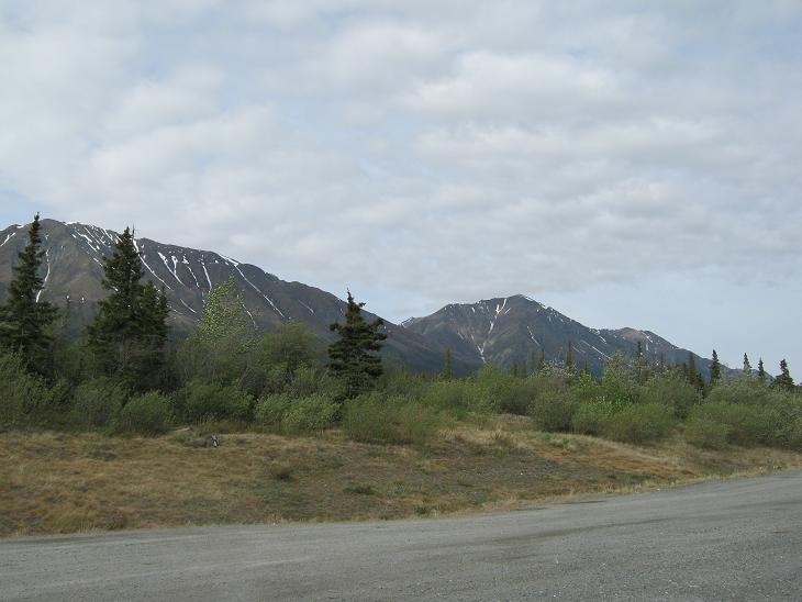
As we got higher in altitude, we started seeing more leftover snow and ice. It is mostly in the crevices and ravines, giving the mountainsides a sort of zebra appearance. The high point in the highway is only about 3300 feet, and I was a little surprised to see that much difference. We stopped for lunch near the high point.


Grizzly Bear
A few miles down the road after lunch, we spotted this guy ambling down the road. Unlike the lighter colored bear we saw before, I'm fairly certain this one was a grizzly. Or as it's known around here, the Alaskan brown bear. Besides the size, the telltale signs are the shoulder hump and the dished silhouette of the head.

Usually when I take animal pictures, the surrounding scenery is worthless, and I end up cropping it out so I can make the animal bigger. A couple of these came out with good backgrounds this time, so I still cropped the bear for a closer shot, but then included the scenery shot too. These are probably my best animal pictures so far.


This may be my favorite picture of the trip so far. Click on it to see it full size.


Yet Another Pullout
Besides another scenic view, I spotted these pretty purple flowers, which I later identified as one of three kinds of lupines that are found in this part of Yukon Territory.


The Elusive Moose
Shortly before arriving in Haines Junction, we finally spotted our first moose of the trip. No chance for a picture, but at least we are no longer skunked.

June 3
Once at Haines Junction, we got back on the Alaska Highway to head down the last stretch of road in Yukon before getting to the main part of Alaska. The road makes a wide swing around Kluane Lake here. Here are a couple pictures at Destruction Bay.


This raven wanted some of our lunch, but we weren't sharing.

Frost Heaves
You may think you know frost heaves, but you probably have not seen frost heaves like these. In our part of the country it's simple. Water seeps into cracks in the pavement, freezes, expands, and pop, you get a pothole. In a permafrost area, it's a lot more complicated than that.

The active layer, which freezes and thaws, sits on top of the permafrost layer, which does not. Water in the active layer seeps down to the permafrost layer and freezes, but of course does not do so evenly. It forms what they call ice lenses, which can push up sections of the active layer. Later, as the ice lenses thaw, large areas may collapse. You can also get big splits in the pavement, and of course you get the ordinary kind of potholes on top of that. There's more to it than that, but it would probably take a geophysicist to explain it. And from what I could tell when I googled it to learn more, I'm not even sure they understand it all that well.

And in the Yukon Territory, I'm not so sure they understand it at all. The last 100 miles or so in YT was probably the worst road I have ever been on. The border agent even commented about it. Said we send them money to keep the road maintained and we should find out what they do with it. I don't know if that's true or not.

I tried to get some pictures to show the road conditions, but of course the worst spots were not conveniently located near a pullout. From several feet up, it was hard to get the right angle to show it well, but I think I got a few good examples.


More Scenery
But in between all the bouncing, there was still some nice scenery:


Is this a swan or a snow goose?

Welcome to Alaska, Part 2
The road improved almost instantly when we crossed the border. We hope that was a good sign.

Ahhh.... New, smooth pavement. The first 14 miles had been freshly paved. We did run into some rough road later on, but nothing like what we saw earlier.

Skinny Trees
It seems the farther north we get, the skinnier the trees get. I'm not sure if this is because they get limited nourishment from the layer above the permafrost, or if it is an adaption to areas with heavy snow. Or both.


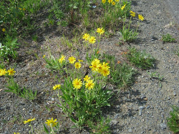
Need To Identify These Yellow Flowers
They seem to be some kind of yellow daisy, but I haven't found anything yet to confirm.

Alaska's Most Abundant Wildlife

Ok, I couldn't resist. I cropped these critters from one of my windshield scenery shots. Those specks are mosquitoes splattered on the windshield. Alaska is well known for its crop of healthy mosquitoes. Believe it or not, this windshield was shiny clean and freshly coated with rain-x at the start of the day.


Monday, May 30, 2011

Alaska Trip 2011: The Road to Whitehorse

This is page 14 of our Alaska 2011 trip journal. Click here for the first page. If you want to bookmark this journal, http://jeanne-travels.blogspot.com always links to the newest page.
Trip Overview
Now that I have figured out how to add Google Maps to the blog pages, I thought it might be nice to post an overview of part of the trip, to help put things in perspective. This is the long stretch of highway between Shelby, Montana, and Whitehorse, Yukon.

If you are looking at this in email, you might not see the map. In that case, just click on "View Larger Map", and it will bring up the map in your browser.


View Larger Map

A. Shelby, MT Last stop before entering Canada
B. Calgary, BC First stop in British Columbia
C. Edmonton, BC Capital of British Columbia
D. Dawson Creek, BC Start of the Alaska Highway
E. Watson Lake, YT First stop in Yukon Territory
F. Whitehorse, YT Klondike Highway crosses Alaska Highway

Whitehorse is a junction point of sorts. There are multiple paths you can take north across Canada to get to Alaska, but they all eventually end up in Whitehorse. Then from Whitehorse there are multiple routes to go on into Alaska. So this is not the last time we will see Whitehorse.

Please let me know if the maps are working for you, and if they are helpful.

Saturday, May 28, 2011

Alaska Tril 2011: May 24 - Whitehorse Day Two

This is page 12 of our Alaska 2011 trip journal. Click here for the first page. If you want to bookmark this journal, http://jeanne-travels.blogspot.com always links to the newest page.

We slept in a little this morning, then headed out for some more points of interest in Whitehorse.

Beringia Center
This museum is dedicated to some of the natural history of the Yukon, some of which applies to Alaska as well. A good portion of Yukon and Alaska was untouched by glaciers in the ice age. The coastal mountains trapped all the snow, so there was simply not enough moisture to create glaciers. This makes the area highly attractive to archaeologists, since the land was not scoured clean by the movement of the glaciers. To highlight this, they have models of the wooly mammoth outside the building, and a skeleton on the inside.


When they talk about a land bridge from Siberia to Alaska, I always imagined a narrow strip of land at the point where you can see Russia from Alaska. There was actually a huge strip of land between the two continents. This map shows the relative position of the land, which they called Beringia. It's a lot easier to imagine people crossing that stretch of land than it is to think about them finding a narrow bridge. As the ice age ended and the massive glaciers began melting, the seas rose accordingly, and this stretch of land was inundated.


Apparently they have found skeletal remains of beavers as large as bears, so native tales about the giant beaver were not just myth.

The World's Largest Weathervane
OK, it's not the largest ball of twine, but it was interesting. They have mounted this DC-3 on a pedestal that allows it to rotate in the wind. There was only a slight breeze while we were there, but it was enough to move it around. They say it only takes 3-4 mph breeze to make it move. A rooster on a barn probably takes that much before it moves.


Yukon Transportation Museum
Dedicated to various means of transportation in Yukon, it had displays related to the building of the Alaska Highway, plus a few vintage vehicles, boats and airplanes.


Miles Canyon
After supper, we took an evening drive through Miles Canyon, just south of Whitehorse. This scenic, narrow canyon has almost vertical walls. The rock here is basalt from a now-extinct volcano. When the lava cools, it contracts, and fractures vertically. You can see these vertical lines on the canyon walls. When the river cuts through the area, the rocks split along these fractures, leaving the vertical walls.


There is a footbridge that crosses the canyon here - I walked out onto the bridge to get good views up and down the river.


We also saw these little purple flowers, which I later identified as wild crocus.


Above Miles Canyon
Further up the road, there was an overlook that looked down at the canyon where we just were. It also had some nice views looking the other direction.


On the way back to town, we drove by the lake and saw this float plane on the water, getting ready to take off...


...And saw a few more parked on the bank. We did not catch the plane taking off, because when it got to the position it wanted for takeoff, we were not in a position to catch it.

What's Next
We are still at 3500 miles traveled in the motorhome this trip, and I forgot to check how many miles in the trailblazer. Tomorrow, we will leave the Alaska Highway for a while, and take a side trip to Skagway. This is where we will actually go into Alaska for the first time.