Showing posts with label North Dakota. Show all posts

Tuesday, May 17, 2011

Alaska Trip 2011: May 9 - North Dakota Badlands Revisited

This is page 3 of our Alaska 2011 blog. The first page is here. Still clearing up some loose ends from the 2009 Glacier trip - We missed part of Theodore Roosevelt National Park due to road construction, so we thought we would take a day and see the rest of it.
Roadside Overlooks

It was another wet and rainy day today, making the badlands a little grayer than last time we were here. There also did not seem to be as many animals out and about as before. Still, it was a good drive, and the badlands always provide some interesting scenery.
Cannonball Concretions
These round rocks are formed by silt deposits around a central core. The description sounded similar to an oyster making a pearl. There were some that were more round than these - they called them cannonball concretions because they resemble cannonballs made of concrete. I thought this broken one was interesting.
Oxbow Bend
The Little Missouri River had changed course some time in the past and this bend in the river is normally dry. The only time you can see water in the bend is when the water is high, which it was the day we were here.

While at the Oxbow Bend overlook, I turned around and took a picture of the plateau behind us.

I also got this shot of a trailhead. Looks like the bison wanted to use the trail too. I called it the Bison Poop Trailhead.
More Views from Road
We did manage to see some wildlife while here - some bison and deer. Remember you can click any of these pictures to see a larger version.

Another interesting rock formation - looks like a giant flat-topped mushroom.

Last but not least, a nice shot of the road on the way out.
More Badlands and Indian History
We stopped at a couple other sites in the ND badlands, but did not take any other pictures. The weather was pretty dreary and wet today, but I guess you can't expect nice weather every day.

Monday, May 16, 2011

Alaska Trip 2011: May 7-8 - Indians and Explorers in North Dakota

This is page 3 of our Alaska 2011 blog. The first page is here. When we did the Glacier trip a couple years ago, there were a few places in western North Dakota that we had to skip because there was not time. We decided to take a couple days on this trip to see them.
Fort Mandan State Historic Site
Fort Mandan is a reconstruction of the fort that Lewis and Clark built to spend the first winter on their expedition. The Mandan and other Indians in the area were mostly friendly, so the fort was as much for protection from the winter weather as it was for defense. It was triangular in shape - three walls - with the cabins and storerooms built in along each wall. They said the reconstruction was not at the original site, which they believed to be now under water.

The first picture is looking in the entrance of the fort, where you can see the flagpole in the center, and entrances to some of the rooms along the wall. The other shot is from further back, showing the entire fort.
Knife River Indian Villages National Historic Site
Apparently I forgot to take pictures here...
This National Historic Site is at the location of an old Mandan Indian village. It has a reconstruction of one of the sod homes, and an interpretive trail that describes some of the other structures that were in the village. There were also exhibits at the visitor center, and we saw a short movie about Mandan Indian life. Like other National Historic Sites, this one was interesting and informative.
Lake Sakakawea
Up here, they have a different spelling and pronunciation of the name of Lewis & Clark's Indian guide. We know her as Sacagawea, which I think is the more common interpretation. Or at least it's the one they used on the Sacagawea dollar coin.

Garrison Dam is on the Missouri River, creating Lake Sakakawea, which stretches across a good portion of the western half of North Dakota. The earthen dam reminds me of Lake Shelbyville near home, but on a much larger scale. I suppose that makes sense, as they were both Corps of Engineers projects.


The first picture is from the top of the dam. The large cylindrical structures are filled with air, and serve as a shock absorber of sorts for the water coming through. The next picture is also from the top of the dam, looking out across the lake. Most of the winter ice has now melted, but you can still see some where the waves lapped up on the far shore. Some of these pictures also give a pretty good look at how gloomy and rainy it was the day we were here.
Unlike Lake Shelbyville, Lake Sakakwea has a spillway that is used to prevent water from breaching the top of the dam. And the rip-rap is pinkish instead of white. This picture of the spillway shows some of the leftover ice accumulating near the spillway gates. There was no water running on the other side, so I presume it was blown there by the wind.
Here are a couple more shots across the lake from near the spillway. We didn't stay here very long, because the wind blowing across the lake was pretty cold. These shots also give a pretty good look at the clouds. We had light rain off and on all day, but thankfully no heavy rain.


Double Ditch

Double Ditch was another old Indian settlement. I don't remember if it was Mandan, Hidatsu, or Arikara. All three were similar, and in the same general area. Archaeologists called this area Double Ditch because of two concentric ditches around the perimeter of the village. The ditches were used for defensive purposes, sort of like a moat or battlement. They had upright poles to make it difficult to cross. The outer of the two ditches was the older, and was apparently when the village was at its population peak. The newer ditch was built later, as the population shrank.

While at double ditch, I took another picture looking out across the prairie. This is pretty typical prairie scenery - a whole lotta nuttin.

Missouri River
Here are a couple nice shots of the Missouri River below the Dam:


Sunday May 8: Travel Day
On Sunday, we moved from our spot near Bismarck, to Dickinson, ND, for one more day of sightseeing before we move on to Montana. This part of North Dakota is apparently experiencing some kind of an Oil Boom. You see lots of wells and drilling rigs, trucks carrying drilling equipment and supplies, and camp sites with row after row of identical small travel trailers, apparently for the workers to stay. I'm guessing there is no unemployment problem here. I'm not sure why it takes so many workers and so many trucks - I guess I need to learn more about driling for oil.

Sunday, May 8, 2011

Alaska 2011: May 4-6 - Crossing the Great Plains

This is the second page of our Alaska 2011 trip. The first page is here.
Shake and Rattle, but thankfully no roll
We woke up Wednesday morning to a howling wind. Forecast only called for 30 mph but it was definitely stronger than that. To top it off, we had some electrical problems in the coach - most of the outlets were dead, and every time we reset the breaker, it popped again. So it was starting out to be not such a good day.

We took care of our business at Blue Ox, and then ended up calling Holiday Rambler where we learned that there is a reset button on the inverter. When we reset that, everything was fine. But the wind problem did not go away. We decided it was too windy to be out on the road, so we arranged to stay another night before taking off.
What do you do in Pender, NE?
The answer is not much. The town is about 10 blocks square. Blue Ox is the major industry, and the biggest business seemed to be a really big John Deere dealer. They did have a city park with exactly one geocache, but that didn't take long.

We ended up driving over to a state park we had spotted near the border, with a Lewis & Clark exhibit. Turns out the park was still closed for the winter, so there wasn't much to see. But there was this really amazing stump. Except for the roof someone added, it's all real. I think a whole family of gnomes could live comfortably in there.
On the road again
Thursday brought calmer winds, so we continued North on I-29. Surprisingly, we actually saw some "leftover" snow that had not yet melted. It was in spots that probably would have attracted deep drifts, and protected so it would melt slower. This was our longest driving day so far, at 384 miles.

Friday was more of the same. A few more patches of snow as we got farther north, but mostly just a lot of nothing. We stopped a little west of Bismarck. We are now over 1,000 miles total for the trip, which puts us just over 1/4 of the way to Fairbanks. The Western half of North Dakota actually has a few places to see, so we will do a little sightseeing the next few days.

Friday, September 18, 2009

Vacation 2009 - Theodore Roosevelt National Park

This is the last page of our vacation 2009 blog. The first page is here.

Theodore Roosevelt National Park
This page is dedicated to Ted, who wondered why anyone would want to go to Theodore Roosevelt National Park. Though it was spread across two days, we spent a total of about one full day here, and will probably be back sometime. Knowing that we were running short on time, we rarely strayed very far from the car, but there were a few places we would have liked to explore a little further.

Not being a historian, I don't know much about Teddy Roosevelt's politics, but I have come to respect the role that he played in preserving some of our country's greatest treasures, and in helping to get the National Park idea off the ground. It is fitting that he has a National Park that bears his name, and this location in the North Dakota badlands, where he once lived, is an appropriate place for this honor.

About the Park
The park actually has three disconnected units - the North Unit, the South Unit, and in between, the largely undeveloped original Elkhorn Ranch site
Those of us who love to see natural beauty are thankful that the best places for sightseeing are often the worst for commercial development. I don't know why the separate units of this park are spread so far apart, but I suspect it is because there is tillable or grazable land in between. The South Unit, being right on I-94, sees the most visitors. The North Unit is similar to the South, though there are some differences in the wildlife populations at the two areas. The Elkhorn Ranch unit is the actual site of Roosevelt's second ranch house, though the ranch buildings are no longer there, and it is pretty much undeveloped at this point. We did not stop at the ranch site, though we would have considered it if we had more time.

North Unit

Most of the North Unit was closed for road construction when we were there. We could only drive as far as the campground and then back out. It's a good thing we weren't planning to camp here - it would have been a little tight getting the motorhome comfortably into one of the campsites, though we probably could have done it. We saw a good sized herd of buffalo near the campground, and another crossing the road on the way back.
They seem to like this picnic shelter. I don't think we will be stopping there today.
I hope these people take a look outside their tents before they step outside.

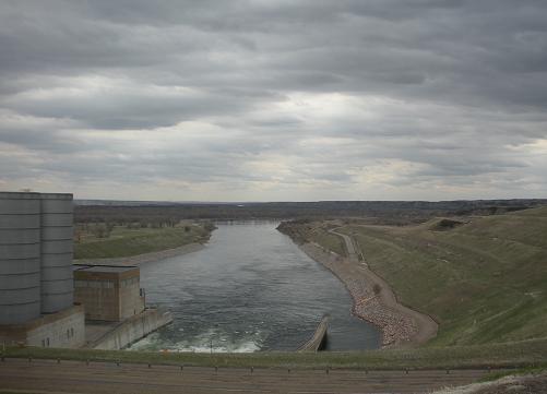
Painted Canyon Rest Stop
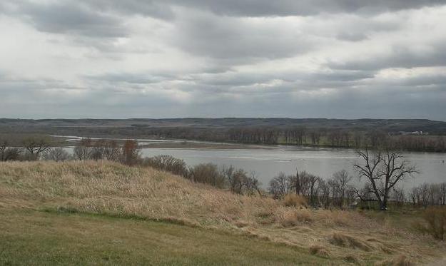
I-94 closely follows the southern border of the South Unit. At one point, the highway crosses a corner of the park. Painted Canyon is not only a regular highway rest area, with truck parking and everything, it is also a National Park Service visitor center. This area provided probably the best overall view of the North Dakota badlands.


South Unit
We spent the night at a campground in Medora, a town near the entrance to the South Unit. Then we were up early again, to spend a few hours in the park before we hit the road again. We plan to go around the Scenic Loop Drive, which should take us to some of the highlights of the park.

Prairie Dog Metropolis
There were several prairie dog towns along the road, some of which were quite large. It left me wondering if there was a shortage of natural predators. But they seemed fat and happy, so I don't suppose they were badly overpopulated.


Buffalo Herd
This bison herd was crossing the road in front of us. At one point something scared them (not us, we were sitting still watching) and they started running, but still in the road. We were finally able to slowly weave our way past them. We took these pictures from the car as we drove by.


More View from Along the Road
It may not be the mountains, but it has a beauty all its own.


Coal Vein Trail
We took the road to the trailhead for the Coal Vein Trail. This would be an interesting walk to take someday - there was a coal vein that actually burned underground for several years. The trail highlights some of the changes resulting from that long burning. What we did see along this road was a herd of wild feral horses. I think this is the first time I had ever seen horses in the wild. This group seemed to be led by the white stallion you see in the third picture.


More Wild Horses
A little further down the road, we saw another group of wild horses right on the road. This group was led by a black stallion.


On The Road Again
We bid farewell to Theodore Roosevelt National Park, and are back at the campground by 11 am to start the journey back to Illinois. The rest of the trip is fairly uneventful. We enjoyed the trip a lot, even though we packed a lot of miles and a lot of sights into a short two-week trip. The weather was wonderful, warm days and cool nights. The only time it rained was just a little ways before we got to Bloomington on the way back. This was just in time to soften the grime before we took the motorhome to the truck wash to get rid of about 4,000 miles of dirt and bugs.