Friday, September 18, 2009

Vacation 2009 - Theodore Roosevelt National Park

This is the last page of our vacation 2009 blog. The first page is here.

Theodore Roosevelt National Park
This page is dedicated to Ted, who wondered why anyone would want to go to Theodore Roosevelt National Park. Though it was spread across two days, we spent a total of about one full day here, and will probably be back sometime. Knowing that we were running short on time, we rarely strayed very far from the car, but there were a few places we would have liked to explore a little further.

Not being a historian, I don't know much about Teddy Roosevelt's politics, but I have come to respect the role that he played in preserving some of our country's greatest treasures, and in helping to get the National Park idea off the ground. It is fitting that he has a National Park that bears his name, and this location in the North Dakota badlands, where he once lived, is an appropriate place for this honor.

About the Park
The park actually has three disconnected units - the North Unit, the South Unit, and in between, the largely undeveloped original Elkhorn Ranch site
Those of us who love to see natural beauty are thankful that the best places for sightseeing are often the worst for commercial development. I don't know why the separate units of this park are spread so far apart, but I suspect it is because there is tillable or grazable land in between. The South Unit, being right on I-94, sees the most visitors. The North Unit is similar to the South, though there are some differences in the wildlife populations at the two areas. The Elkhorn Ranch unit is the actual site of Roosevelt's second ranch house, though the ranch buildings are no longer there, and it is pretty much undeveloped at this point. We did not stop at the ranch site, though we would have considered it if we had more time.

North Unit

Most of the North Unit was closed for road construction when we were there. We could only drive as far as the campground and then back out. It's a good thing we weren't planning to camp here - it would have been a little tight getting the motorhome comfortably into one of the campsites, though we probably could have done it. We saw a good sized herd of buffalo near the campground, and another crossing the road on the way back.
They seem to like this picnic shelter. I don't think we will be stopping there today.
I hope these people take a look outside their tents before they step outside.

Painted Canyon Rest Stop
I-94 closely follows the southern border of the South Unit. At one point, the highway crosses a corner of the park. Painted Canyon is not only a regular highway rest area, with truck parking and everything, it is also a National Park Service visitor center. This area provided probably the best overall view of the North Dakota badlands.


South Unit
We spent the night at a campground in Medora, a town near the entrance to the South Unit. Then we were up early again, to spend a few hours in the park before we hit the road again. We plan to go around the Scenic Loop Drive, which should take us to some of the highlights of the park.

Prairie Dog Metropolis
There were several prairie dog towns along the road, some of which were quite large. It left me wondering if there was a shortage of natural predators. But they seemed fat and happy, so I don't suppose they were badly overpopulated.


Buffalo Herd
This bison herd was crossing the road in front of us. At one point something scared them (not us, we were sitting still watching) and they started running, but still in the road. We were finally able to slowly weave our way past them. We took these pictures from the car as we drove by.


More View from Along the Road
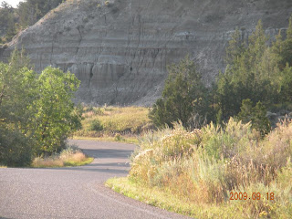
It may not be the mountains, but it has a beauty all its own.


Coal Vein Trail
We took the road to the trailhead for the Coal Vein Trail. This would be an interesting walk to take someday - there was a coal vein that actually burned underground for several years. The trail highlights some of the changes resulting from that long burning. What we did see along this road was a herd of wild feral horses. I think this is the first time I had ever seen horses in the wild. This group seemed to be led by the white stallion you see in the third picture.


More Wild Horses
A little further down the road, we saw another group of wild horses right on the road. This group was led by a black stallion.


On The Road Again
We bid farewell to Theodore Roosevelt National Park, and are back at the campground by 11 am to start the journey back to Illinois. The rest of the trip is fairly uneventful. We enjoyed the trip a lot, even though we packed a lot of miles and a lot of sights into a short two-week trip. The weather was wonderful, warm days and cool nights. The only time it rained was just a little ways before we got to Bloomington on the way back. This was just in time to soften the grime before we took the motorhome to the truck wash to get rid of about 4,000 miles of dirt and bugs.

Thursday, September 17, 2009

Vacation 2009 - Heading to North Dakota

This is page ten of our vacation 2009 blog. The first page is here.
Big Sky Country
If you live in the Midwest, there is one unalterable fact about traveling to the West. It doesn't matter how far North or South you go, you still must cross the Great Plains before you get to the mountains, and you must cross again on your way back.

We drove over 500 miles in Montana after leaving the mountains and Glacier National Park.
As we drive across northern Montana, I can see why they call it "Big Sky Country". Sometimes, the sky is about all you can see. I sit back and imagine that the wheat fields are native grasses, and the grazing cattle are some of the great herds of buffalo that once roamed the area. The occasional towns might be Indian villages. Though the area has changed dramatically in the last hundred years or so, in some ways it has not changed at all.
Believe it or not, I did not take any pictures at all during the trek across the Montana plains
Some day I may retrace the steps of Lewis and Clark across this vast land, or follow the Oregon Trail or the Pony Express. I am sure there are many interesting places in the Great Plains, islands in this great sea, such as we found at North Platte. But for now, these destinations are not as high on my list of places I want to see. When crossing the plains takes a couple days out of a limited itinerary, it seems more of a barrier than a destination.

Fort Union Trading Post
The restored Fort Union Trading Post is on the Missouri River, and is quite literally on the border between Montana and North Dakota. The parking lot is in Montana, and the fort itself is in North Dakota. If you take the right road the first time, it is only about 20 miles off the highway, and is definitely worth a stop if you are traveling on U.S. 2 in the area. We drove a little farther than that, because we were debating whether we had enough time for this stop, and ended up cutting across and coming up from the south.


Fort Union was not actually a military fort, but it was fortified like one to protect the goods and inhabitants. Just inside the front gate, we found the Trading Room, where we chatted with a man in period costume about the fort and how the trading was done.

The first thing you see inside the walls is the bourgeois house, a grand two-story structure that almost seemed out of place amid the more meager surroundings. The fort's manager was known as the Bourgeois, reflecting the French Canadian part of the American Fur Company's background. The Bourgeois and his chief clerk and families lived in the Bourgeois house. Other employees lived in the dwellings and shops outside the house. Some of the employees who took Indian wives lived in teepees outside the fort.


The difference between the Bourgeois house and the outer dwellings was startling. Although there were no restored dwellings on the site, you could see from the foundations that a dwelling was smaller than a typical room in the house.

The restored Bourgeois House, thankfully, was air-conditioned. It was a fairly hot day on the prairie when we were there, and I just don't deal with heat the way I used to. The house now serves as the visitor center, and houses a small museum with artifacts and more information about the trading post and the surrounding area.


North Dakota Badlands

Heading South from Fort Union, we catch our first glimpse of the North Dakota badlands just before getting to the North Unit of Theodore Roosevelt National Park.


Tuesday, September 15, 2009

Vacation 2009 - Last Day at Glacier NP

This is page nine of our vacation 2009 blog. The first page is here.
Going to the Sun Road Revisited
For our last day at Glacier National Park, we took another drive along the Going to the Sun Road to pick up some of the sights we missed on previous days. In particular, we made sure to get an early start, so we would not miss Logan Pass again. Once again, the weather was perfect, though there was a little early morning haze. We only made a couple stops along the way to Logan Pass, as we saw most of the west end of the road again on Day Two.
On the Way to Logan Pass
Here are some views of damage most likely caused by an avalanche. p.s. Look how shiny the car is! Quick, before we pick up more dust!

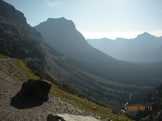
The valley has different look in the early morning haze.
This is a view of Bird Woman Falls. If you look closely, you can actually see the falls coming down at the lowest point between the two closest mountains. I would imagine it is a lot more visible in the spring.

There was a bear on the hillside near the construction site, but we were not able to get a good picture of it.

Logan Pass
We caught a lucky break on the construction, and didn't have to wait very long at all this time. But a couple more minutes, and it would have been a different story! We actually arrived before the visitor center opened.

Logan Pass was definitely worth coming back to see after we missed it the first time across. I'll let the pictures do the talking.


Late Morning Haze
These U-shaped valleys are pretty typical of landscape that has been carved by glaciers. I almost didn't take these pictures, as we were looking into the sun, but in retrospect, it made a pretty interesting effect.


Will the Real Weeping Wall Please Stand Up?
On the west side of Logan Pass, there is a landmark known as the Weeping Wall, so called because of the way the water oozes and runs out of the rocks. It is said that at certain times of the year, you have to roll your windows up and run your wipers as you drive by. The water comes from melting snow fields and glaciers, filtering down through the loose rock. The real weeping wall was barely damp both times we drove by it, but we found this wall on the east side of the pass that was actually weeping.


Siyeh Bend
Siyeh Bend is another scenic spot, with a waterfall on the uphill side, and valley overlooks the other direction.


Sun Point
Dale waited in the car while I took a short hike to Sun Point. The walk was definitely worth it - there were beautiful views of St. Mary Lake, and the surrounding mountains.


St. Mary Lake
More views of St. Mary Lake and Goose Island


St. Mary
We reach the end of the road at St. Mary, where we had dinner at the lodge instead of having our usual picnic. Then we headed back towards West Glacier. We do have a couple more stops flagged for the way back if there is time.

Tunnel With Windows
This was an interesting tunnel. Along the outside wall, there were two openings that you could walk through and look at the view. And of course a sidewalk to get there.

Goodbye to Glacier
As we leave the park for the last time on this trip, we finally remember to get the requisite "Welcome to Glacier" picture at the entry sign. As we bid farewell to this park, I have run out of words to describe the beauty.

Next Page: Headed for North Dakota