Fort Mandan State Historic Site
Fort Mandan is a reconstruction of the fort that Lewis and Clark built to spend the first winter on their expedition. The Mandan and other Indians in the area were mostly friendly, so the fort was as much for protection from the winter weather as it was for defense. It was triangular in shape - three walls - with the cabins and storerooms built in along each wall. They said the reconstruction was not at the original site, which they believed to be now under water.
The first picture is looking in the entrance of the fort, where you can see the flagpole in the center, and entrances to some of the rooms along the wall. The other shot is from further back, showing the entire fort.
Knife River Indian Villages National Historic Site
Apparently I forgot to take pictures here...
This National Historic Site is at the location of an old Mandan Indian village. It has a reconstruction of one of the sod homes, and an interpretive trail that describes some of the other structures that were in the village. There were also exhibits at the visitor center, and we saw a short movie about Mandan Indian life. Like other National Historic Sites, this one was interesting and informative.Lake Sakakawea
Garrison Dam is on the Missouri River, creating Lake Sakakawea, which stretches across a good portion of the western half of North Dakota. The earthen dam reminds me of Lake Shelbyville near home, but on a much larger scale. I suppose that makes sense, as they were both Corps of Engineers projects.


The first picture is from the top of the dam. The large cylindrical structures are filled with air, and serve as a shock absorber of sorts for the water coming through. The next picture is also from the top of the dam, looking out across the lake. Most of the winter ice has now melted, but you can still see some where the waves lapped up on the far shore. Some of these pictures also give a pretty good look at how gloomy and rainy it was the day we were here.
Unlike Lake Shelbyville, Lake Sakakwea has a spillway that is used to prevent water from breaching the top of the dam. And the rip-rap is pinkish instead of white. This picture of the spillway shows some of the leftover ice accumulating near the spillway gates. There was no water running on the other side, so I presume it was blown there by the wind. Here are a couple more shots across the lake from near the spillway. We didn't stay here very long, because the wind blowing across the lake was pretty cold. These shots also give a pretty good look at the clouds. We had light rain off and on all day, but thankfully no heavy rain.


Double Ditch

Double Ditch was another old Indian settlement. I don't remember if it was Mandan, Hidatsu, or Arikara. All three were similar, and in the same general area. Archaeologists called this area Double Ditch because of two concentric ditches around the perimeter of the village. The ditches were used for defensive purposes, sort of like a moat or battlement. They had upright poles to make it difficult to cross. The outer of the two ditches was the older, and was apparently when the village was at its population peak. The newer ditch was built later, as the population shrank.

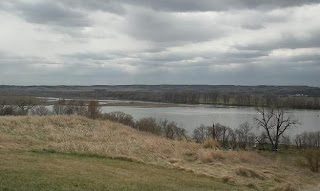
While at double ditch, I took another picture looking out across the prairie. This is pretty typical prairie scenery - a whole lotta nuttin.


No comments:
Post a Comment
Anyone can comment, but I will look at all comments before allowing them to be published, so don't expect them to show up immediately. This is to weed out the inevitable spam posts. If you do not wish to register, you might include a clue in your comment so I can figure out who you are.