Thursday we moved from Valdez to Glennallen. This area once contained one of the richest copper mining areas in the world. From here we will visit the hisitoric town of Copper Center, and Wrangell-St. Elias National Park. Wrangell-St. Elias is our largest national park, encompassing the Wrangell Mountains as well as the St. Elias Range. It also contains part of the Bagley Icefield, the largest icefield in North America, which also extends into Canada. But like many of the parks in Alaska, you can only see a small part of it. Most of it is true wilderness, but there are two roads where you can drive part way into the park.
Fireweed
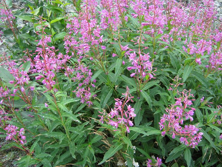 The fireweed is blooming, and I have been watching for a spot to get a good picture. A pullout along the road gave provided an opportunity to see them on the banks of the stream. Fireweed can cover entire hillsides when they are blooming. It is called fireweed, because it is one of the first plants to show up in areas that have been burned.


McCarthy Road
One of the two roads in Wrangell-St.Elias was along an old railroad bed that went to the towns of Kennicott and McCarthy. It was basically a 60-mile gravel road, but we have learned that in this part of the world, gravel roads are not necessarily worse than paved roads. You do have to drive a little slower on them, though. McCarthy was a town that sprung up near the company town of Kennicott, outside of company control. Here you would find services not sanctioned by the mining company, such as bars, and... well, you know. Today there are gift shops, restaurants, and tour guides. Somehow, I failed to get any pictures at McCarthy, but I did get some from along the road.


Although the road was built on an old railroad bed, it bypassed most of the old trestles - they were probably in no condition for traffic. The lighting is not good in this picture, but it shows one of the trestles, which is still standing. Sort of.

On the way in, we saw a camper that had pulled over to allow oncoming traffic to pass, got over the edge of the road, and was leaning precariously. After making sure he had help coming, we went on out way, but on the way back we took a look at the rut he left. It looks like the only thing that kept him from rolling sideways was the fact that his axle bottomed out on the pavement, keeping it from rolling further. These gravel surfaces are harder than they look.
No, the picture is not sideways. It's the edge of the road.
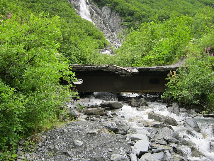
Liberty Falls was not actually on the McCarthy road - it is a state park along the road that goes to McCarthy Road.


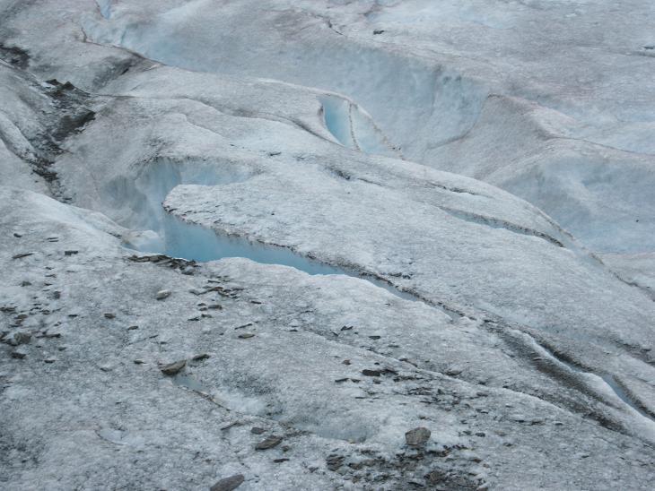
Kennicott Glacier
The Kennicott Glacier ends right near town. The only thing is, it doesn't look like a glacier at this point. At first, I thought these peaks were mine tailings or something, but I learned that is not the case. At one point, the glacier was as much as 175 feet higher than it is now. As the ice melts, some of the accumulated debris is left on top. The peaks and valleys are caused by variations in the thickness of the debris, causing the ice to melt at different rates. If you look closely, you can see patches of ice among the peaks. There are mine tailings here also - they are in the lower, rounded piles of gravel in the foreground. 

Kennicott
Kennicott was basically a company town, where the mine workers lived, along with support personnel, such as food service and health care workers. It was pretty much under the control of the mining company, and was apparently a pretty nice place as mining camps go. The buildings here are in various stages of repair. The park service is in the process of restoring some of the buildings and stabilizing others. Stabilizing means just making it safe to enter, but not changing the appearance of the building. I guess this is so you can view it as if it were the ghost town that it is, but without as much risk. We did not see the mine itself, which was a serious hike up into the mountain.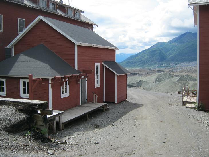


They call this a high rail vehicle. It is used to go from road to rail, and back. Railroads still use them today, for much the same purpose, but with more modern cars, of course.
Mill Tour
See that big, tall building over there? Besides the buildings at town level, our tour took a path up the hill all the way to the top of the mill. We were both huffing and puffing by the time we got there. We had to wear hard hats while we were actually inside the mill. We saw the machinery used to separate most of the rock from the ore. Like the buildings, the machinery was in various states of repair. The only pictures I took inside were a couple of views of the town from the top.


I thought the tour guide's attire was interesting - heavy fleece hoodie, woolly stocking cap, and sandals.

He did show us a good example of copper ore, and the rock that would hae been separated from it at the mill.
Copper Center
The next day we drove to Copper Center, a historic town that is not part of the national park. We had a pretty good lunch at the restaurant there, and went through a nearby museum. We also saw some good views of the Wrangell Mountains from along the road. Typical of mountains around here, you have to look closely to separate mountains from clouds.
Tok Cutoff
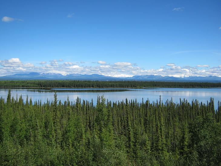
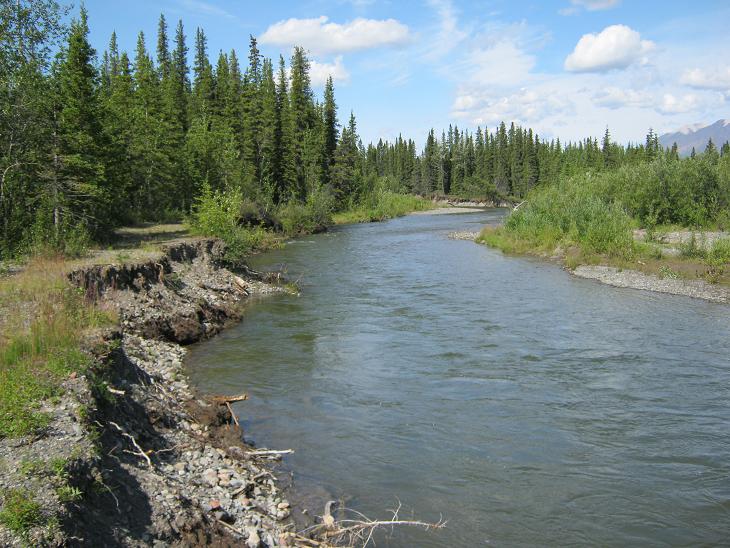
Sunday we packed up and headed for Tok, along a road called Tok Cutoff. so we got out of the car, cut off our Tok...We saw more fields of fireweed, more mountains, and more braided rivers.


Nabesna Road

Nabesna Road is the other road that goes into Wrangell-St. Elias National Park. Like the McCarthy Road, it is also a narrow gravel road. It is a little more rugged than the McCarthy Road, and has three or four water crossings. We start with Mt. Sanford and Mt. Wrangell with their heads in the clouds, followed by some wildflowers.


 Here's a mystery. Why was there a single mushroom, looking quite fresh, just laying in the middle of the road?
More Scenery along the way

We reached the end of the road. Actually, it looked like it might have been possible to go further, but the sign did say Road Closed. There were more mystery mushrooms here, but these were smaller and still growing.


These yellow and white flowers were pretty much identical except for the color.


On the way back, we snapped some more scenery, and a spot where the road was beginning to wash away.


Completing the Circle
This might be a good place for a map.
When we returned to Tok, it was the completion of the full circle around the state. Or at least the part of the state that has roads. We still have a couple places left in Alaska to see, but at this point we have closed the loop.