Sunday, July 31, 2011

Alaska Trip 2011: July 10-13 Anchorage, Palmer, and the Road to Valdez

This is page 33 of our Alaska 2011 trip journal. Click here for the first page. If you want to bookmark this journal, http://jeanne-travels.blogspot.com always links to the newest page.

Sunday we continued our journey around the state, moving eastward now. We drove past Anchorage to Palmer, to get away from the city. From there, we drove the car back to Anchorage a couple times, for a little sightseeing and some errands. Then we drove from Palmer all the way down to Valdez, passing by a couple spots we will see on the way back.


View Larger Map
Anchorage
At about 275,000, Anchorage is the largest city in the state, and home to 40% of the population. The next largest cities are Fairbanks and Juneau, both in the 30,000 range.

We stopped at the visitor center downtown, where we met this sleepy-looking bear. A drive around the harbor yielded a view of the city skyline. The last view is from Earthquake Park, which commemorated the 1964 earthquake. The bluff we were standing on is above where the ground sunk during the quake. That spot will probably go down in the next quake. The clay underneath is of a type that basically turns to jelly when it shakes. This is only a matter of time, since this part of Alaska is on the Pacific Ring of Fire.


Alaska Native Heritage Center

We visited the Alaska Native Heritage Center, which had a museum, and some examples of native dewllings from the various tribes found in Alaska. There was also a presentation of native dancing. The strange-looking archway is the jawbone of a whale.
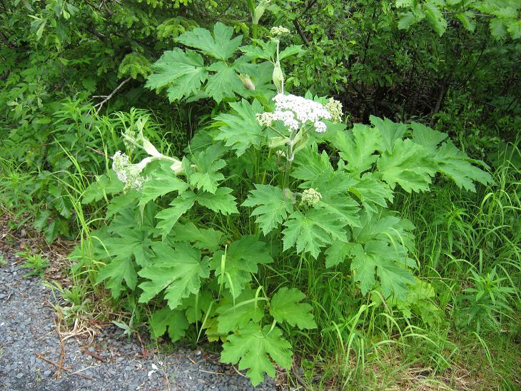

Palmer
Not much to see in Palmer. Supposedly they grow the world's largest vegetables, which they attribute to lots of sunlight from the long days, and lots of rain. We didn't see any of the giant veggies here, but we didn't look, either.

Palmer to Valdez

We stopped at Hatcher Pass, where the overlook gave us a really good view of what a braided river looks like. The water wanders about, changing course frequently within the wide banks. The gravel bars that have been around for a while start to grow vegetation; the others are bare. Ironically, when we walked back from the overlook, we met a couple taking a picture, not of the scenery, but our motorhome. They were from South Africa, and apparently they don't have big motorhomes there.

The Matanuska Glacier was visible from the road. As you can see in the pictures, this one is fairly large compared to some of the other glaciers we have seen.


More views from along the Glenn Highway, between Palmer and Glennallen, including Fireweed, which is just now starting to bloom.


Oh No! Flat tire!
At Glennallen, we turned south toward Valdez. When we pulled into a rest area a little past the turn, we discovered a flat tire on the trailblazer. There were no signs that it had run on the rim for any distance, so it was either a slow leak, or it just happened when we pulled in. We went the rest of the way to Valdez on the spare. It was a pretty big piece of metal, and the tire had to be replaced. The last picture shows the whole piece of metal after it was pulled from the tire.


Glacier Preview
Here is a preview of Worthington Glacier, as seen from a pullout on the road. We will visit this area later in the week.


Tuesday, July 26, 2011

Alaska Trip 2011: July 5-9 More Kenai Peninsula

This is page 32 of our Alaska 2011 trip journal. Click here for the first page. If you want to bookmark this journal, http://jeanne-travels.blogspot.com always links to the newest page.

After the holiday weekend, we moved from Seward to Soldotna. We chose this as a more or less central location for exploring the western side of the Kenai Peninsula. The eastern side of the peninsula is pretty much locked in by the Harding Icefield, but if you are a fisherman, the western Kenai is something this side of paradise. It's not only a beautiful area, but I guess the fishing is wonderful. Since we don't fish, we just enjoyed the scenery. Besides sightseeing, we also did a little just hanging out and relaxing.


View Larger Map

Kenai Weather
We actually took a drive to Soldotna before we moved the motorhome there. For some unknown reason, I only took a few pictures on the way. The first is a view of Skilak Lake, with the clouds hanging over the mountaintops as usual. The other picture is a rainbow that showed up when it started to rain. The weather in this area is pretty much a mystery to me. I think it's a mystery to the weather people too. They keep changing the forecasts, but the weather has stayed mostly the same. Because of Pacific Ocean currents from the Gulf of Alaska, it's cool-ish in the summer, and warm-ish in the winter. And it will probably rain, or at least sprinkle, some time during the day.


Trip to Homer
We took a sightseeing trip to Homer, at the southern tip of the Kenai Peninsula. Homer is basically a small fishing town, with both commercial and sport fishing. The road mostly follows the Cook Inlet, with periodic views of the Aleutians across the bay.

Moose Story
Just south of Soldotna, we spotted this moose family. I think these are my best moose pictures so far. Here's the story: Moose and babies grazing peacefully along road. Oncoming motorist, apparently annoyed at stopped traffic, blows horn on the way by, and critters start toward woods. Then moose pause to see if they are still being pursued. Finally they head into the woods


Cook Inlet
Some views of Cook Inlet from an overlook along the road, from Ninilchik Beach, and from near Homer. Some of the mountains are hard to see through the haze.


These wild geraniums were at an overlook near Homer.

The Farthest West You Can Drive
At 151 degrees, 52 minutes West, the beach at Anchor Point is the westernmost place that you can get to by car, not just in Alaska, but anywhere on the continent. Anchor Point also provided some scenic views of the bay, and a view of eagles and gulls fishing in the low tide.


The Russian Influence

This area was originally settled by the Russians. This historic Russian Orthodox church was in one of the small communities along the road to Homer.

City of Kenai
The next day we drove to the city of Kenai, and from there to Captain Cook State Park. The views on this drive were similar to those on the road to Homer, all the way down to the Russian Orthodox church, and the hazy views across the inlet.


R & R
Beide sighteeing in the area, we also spent a little time just "hanging out" and relaxing. It's good to do that from time to time, and we are getting better at it, the longer we are on the road. I also a geocaching "meet and greet" event that coincidentally happened while we were in Soldotna. How could I pass up a chance to go to a geocaching event 3000+ miles from home?


Friday, July 22, 2011

Alaska Trip 2011: June 29, July 1 - Kenai Fjords

This is page 31 of our Alaska 2011 trip journal. Click here for the first page. If you want to bookmark this journal, http://jeanne-travels.blogspot.com always links to the newest page.

If you are watching the dates on these posts, you will notice a couple days here out of sequence. Sometimes I like to cover things in a logical sequence, rather than jumping around from place to place and back.

The Harding Icefield and the glaciers flowing from it cover over 700 square miles, making it one of the the largest icefields in North America. They are not sure how deep it is, but they do know it is over 1,000 feet in some places. Kenai Fjords National Park encompasses part of this area.


View Larger Map

This map shows a satellite view of the area. The large, white area is the Harding Icefield. The grayish stripes coming between the mountain tops are the glaciers spawned from the icefield.

Exit Glacier
Exit Glacier is northwest of Seward, along the eastern of the icefield. It is the only place where you can get into the national park by road. Other than that, it is only accessible by sea or air. They called this one Exit Glacier, because it was the most convenient place for expeditions to exit the icefield.

The first view of the glacier is along the road into the park. The glacial stream at this point was also quite high, although I'm quite sure it is a wide braided river somewhere behind the brush. It just happened to braid itself along the road at this point. In other words, it has a lot of room to spread before it encroaches on the road.


From the visitor center you can take a short hike to a closer view of the glacier, or a much longer hike up to the icefield. I probably would have enjoyed seeing the icefield, but the distance and elevation change would have been a lot more than I could have handled. We did take the shorter hike, though. We were also able to walk out onto the outwash plain, but not all the way to the glacier.


And what would a walk in the woods be without more wildflowers? Seems every place we go, we see something else that we have not seen before. First is Pink Pyrola, also known as Arctic Wintergreen, the other two pictures are Columbine.


We first saw Cow Parsnips around Trapper Creek. They are huge, looking like Queen Anne's Lace on steroids, but prickly and feeling like stinging nettles. In some areas they dominate the roadside, to the exclusion of other plants. I'm not sure if they are a wildflower, or more like a weed.


This isn't a wildflower, but still it was interesting. Notice how most of the leaves are missing from the bushes here. These are willows, a favorite treat for moose. We also saw mooseberries (i.e. scat) along the path, so it was pretty clear there had been moose in the area fairly recently, making the path into a bit of a smorgasbord. But they probably make themselves scarce during the daytime when there are a lot of people around. At any rate, we didn't see any while we were here.

Kenai Fjords Glacier Cruise
We took a tour boat to see some of the glaciers from the water, and hoping to see some calving as well. The tour focused more on the sea life than the glaciers, so I was a little disappointed about that. But we did see sea life, and a calving glacier, and beautiful scenery, so it was still a good trip.


Humpbacks
Of course we saw humpback whales, but the pictures we got were not as good as the last trip. We also saw orca later in the trip, but were not able to get pictures.


Sea Lions

We saw sea lions surrounded by beautiful scenery, but no harbor seals on this trip...


Puffins
Puffins are strange birds, looking kind of like a cross between a penguin and a duck. They stand like a penguin, and swim like a duck. These are the only puffins we have seen, so I am including the pictures even though they are really fuzzy and bad.


There were also three cormorants on a nearby ledge. You can't see them very well in the picture because it's so fuzzy.

Bear Glacier

It's hard to tell from the picture, but Bear Glacier is land-locked, so we did not cruise up to it. So far, it is one of the largest glaciers we have seen, even though it was only at a distance.

More Scenery
These pictures were taken as we sailed around the point into Aialik Bay to see Holgate Glacier.


Holgate Glacier

A glacier that ends in the sea is called a tidewater glacier. When ice chunks fall from a tidewater glacier, it is called calving. The calving causes the glacier to pretty much end in a huge wall of ice. Holgate is our first view of a tidewater glacier. The first picture was actually taken as we left the area, but it's the best view of the entire glacier. When you get closer to the ice wall, you can't see the top as well.


The next two pictures show the ice wall - the second is a closer view near the top. As the glacier moves downhill, it splits and breaks, creating sometimes deep and treacherous crevasses. You can actually hear the breaking, echoing across the crevasses, and sounding almost like rifle shots. You can see some of the splits here, but I think you have to be on top to atually see much of the crevasses.


The next picture shows a little waterfall squirting out from under the glacier. Of course that is not the only water coming from the glacier, but most of it is not visible.


The pile of ice in the next picture is fallen ice from the calving.


Nearby Views

There was another glacier also coming down to the Holgate Arm, though it was landlocked. Here is a picture of it, and a couple other spots on the crest of the Holgate Arm.


Icebergs
The glacial ice crackles and pops like rice krispies as it melts in the water. This is caused by air that was trapped as the ice crystals formed. I took some pictures of the icebergs, including one with a sea lion basking on top.